In 2004, a total of 199.4 miles of road were surveyed in the Big Canyon Creek watershed. For full details of the survey review the Big Canyon Creek Roadside Weed Inventory report. Overall, 16 weed species were observed ranging from 0.1 to 144.6 miles of road segments (Table 3). Total lengths for all weed segments observed is available in Table 3. Canada thistle (Cirsium arvense) and St Johns Wort (Hypericum perforatum) were widely distributed, being observed along 144.6 and 105.0 linear miles of road segments. The distribution of other weeds will be discussed by groups as defined by the CBWMA.
Table 3. Weed Species and Length of Infestation Present in the Big Canyon Watershed.
| Weed Species | CBWMA Group | Length (miles) |
| Canada Thistle | Reduce | 144.6 |
| Yellowstar Thistle | Reduce | 19.5 |
| Spotted Knapweed | Reduce | 6.1 |
| Total | 170.2 |
| Sulfur Cinquefoil | Custodial | 43.2 |
| Field Bindweed | Custodial | 37.4 |
| Total | 80.6 |
| Tansy Ragwort | Eradicate | 6.8 |
| Yellow Toadflax | Eradicate | 0.1 |
| Total | 6.7 |
| Poison Hemlock | Contain | 2.0 |
| Scotch Thistle | Contain | 1.3 |
| Hybrid Knotweed | Contain | 0.1 |
| Total | 3.4 |
| Dalmatian Toadflax | Control | 0.4 |
| Total | 0.4 |
| St. John’s Wort | Other Species | 105.0 |
| Hounds Tongue | Other Species | 10.9 |
| Common Tansy | Other Species | 10.9 |
| Bull Thistle | Other Species | 0.3 |
| Common Burdock | Other Species | 0.2 |
| Total | 127.3 |
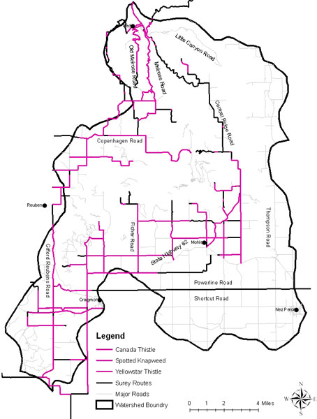
Reduce
Canada thistle, yellowstar thistle (Centaurea solstitialis), and spotted knapweed (Centaurea maculosa) were the three species observed and classified in the reduce group. Overall, the three were observed along 170.2 miles of road (Table 3.)
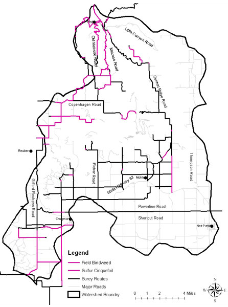
Custodial
Sulfur cinquefoil (Potentilla recta) and field bindweed (Convovusus arvensis) were the two species classified in the custodial group; they were observed along 80.6 miles of road (Table 3).
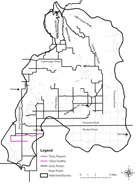
Eradicate
Tansy ragwort (Senecio jacobacea), and yellow toadflax (Linaria vulgaris) were the two species classified in the eradicate group. Combined, they were observed along 17.8 miles of road (Table 3).
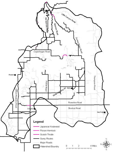
Contain
Poison hemlock (Conium Maculatum), scotch thistle (Onopordum acanthium), and hybrid knotweed (Polygonum bohemicum) were the three species observed from the contain group. They were observed along 3.4 miles of road (Table 3).
Control
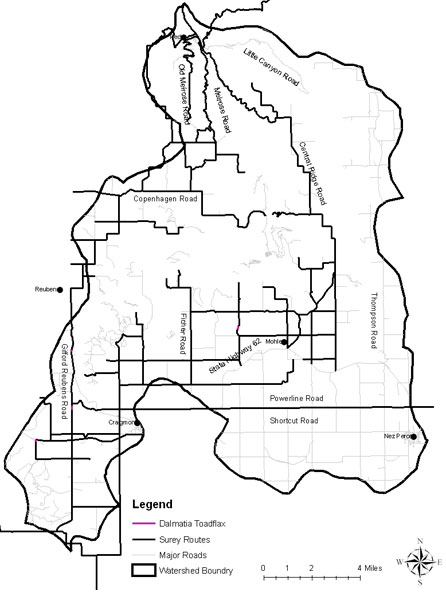
Dalmation toadflax (Linaria dalmatica) was the only species observed in the control group. It was observed along 0.4 miles of road (Table 3).
Other species
St. Johns Wort, bull thistle (Cirsium vulgare), hounds tongue (Cynoglossum officinale), common burdock (Arctium minus), and common tansy (Tanecetum vulgare) were observed along 116.4 miles of road. These introduced species are not addressed by the CBWMA, but were noted during the weed surveys.
Discussion/Recommendations
We recommend the eradication of all weed species distributed along less than 10 road miles throughout the entire watershed. These species are listed in Table 3. Reducing their distribution along these roads may slow or prevent further distribution. Eradication methods might include chemical, mechanical, or biological means.
Due to limited resources and available methods of control, widely distributed weeds will be approached differently (Table 3). For these species, we recommend efforts to slow, not eliminate, distribution. Treatments may include: treating the leading edge of infestations, eradication of small isolated infestations, or use of bio controls over the entire distribution. Species with extensive distributions should be treated by methods that treat at an appropriate scale, such as biological controls. These species include: Canada thistle, Yellowstar thistle, Spotted Knapweed, and St. Johns Wort.