Project Description:
| The project consists of mapping rush skeletonweed (Chondrilla juncea) locations in Nez Perce and Lewis counties, Idaho. Mapping occurs on public and private lands where landowner permission is obtained. The Clearwater Basin Cooperative Weed Management board identified rush skeletonweed as a high priority in order to contain the level of infestations in our area. Historically, landowners near the Peck, Idaho area had reported observing the weed near the town site. Nez Perce County completed some inventory work in 2007 which confirmed the siting’s and identified areas along Big Canyon Creek with weed infestations. | 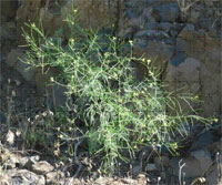
Figure 1. Rush skeletonweed mature plant. Photo credit: Cody Dawes; Nez Perce Soil and Water Conservation District. |
The conservation district became involved at the request of the Clearwater Basin Cooperative Weed Management board.
This project is a partnership effort with the Idaho Department of Agriculture, Clearwater Basin Cooperative Weed Management Area, Nez Perce County, Lewis County and the Nez Perce Soil and Water Conservation District. Mapping efforts began in 2013.
The project addresses the following goals from the Clearwater Basin Weed Management Area strategy:
- Prevent the introduction, reproduction, and spread of noxious weeds and invasive plants into and within the Clearwater River Basin.
- Eradicate new outbreaks of established invasive plants.
- Reduce the density of established noxious weeds and invasive plants to a point that natural resource damage is within acceptable limits.
- Implement the most economical and effective control methods for the target species.
2013 Mapping Results
District staff conducted a rush skeletonweed mapping effort in the Big Canyon Creek watershed along Big Canyon Creek Road and Central Ridge Road in July 2013.
Overall, 142.48 acres were inventoried and 35.593 acres were identified as infested with rush skeletonweed. The maps shown below illustrate the areas of infestation found during 2013.
Figure 2. Nez Perce County Rush Skeletonweed Infestation Locations. Map Credit: Amanda Hall; Nez Perce Soil and Water Conservation District.
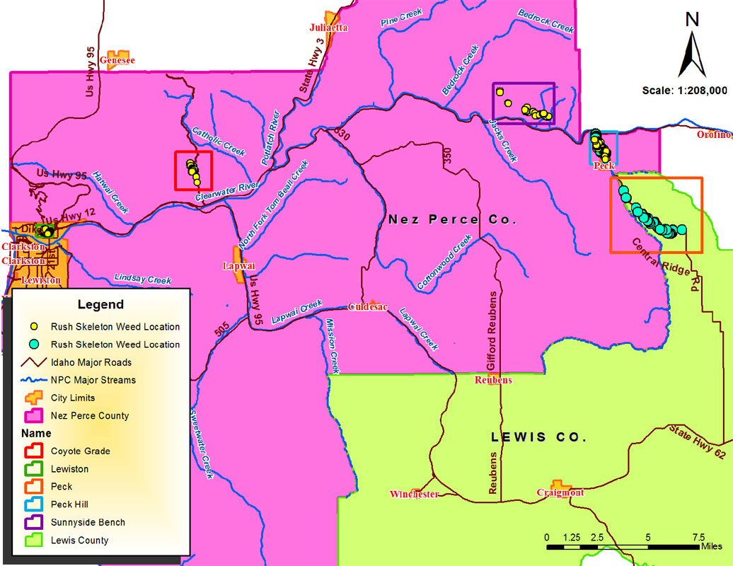
Figure 3. Lewiston Rush Skeletonweed Infestation Area Detail. Map Credit: Amanda Hall; Nez Perce Soil and Water Conservation District. 2013.
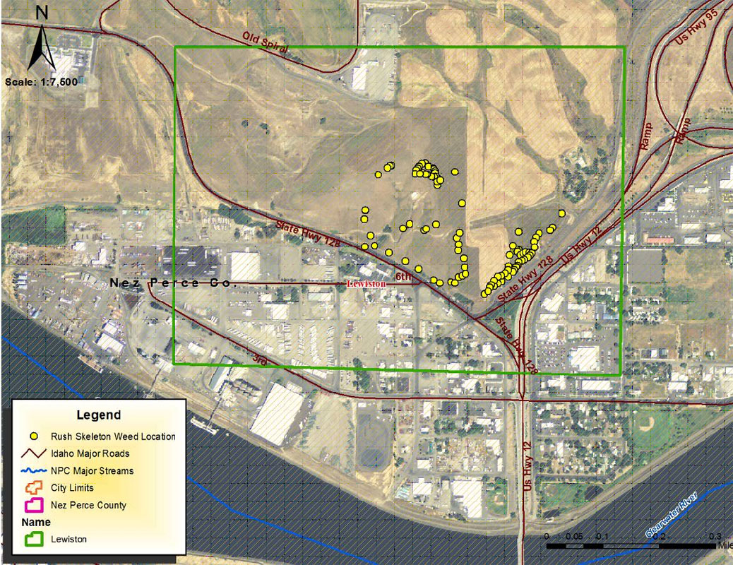
Figure 4. Coyote Grade Rush Skeletonweed Infestation Area Detail. Map Credit: Amanda Hall; Nez Perce Soil and Water Conservation District 2013.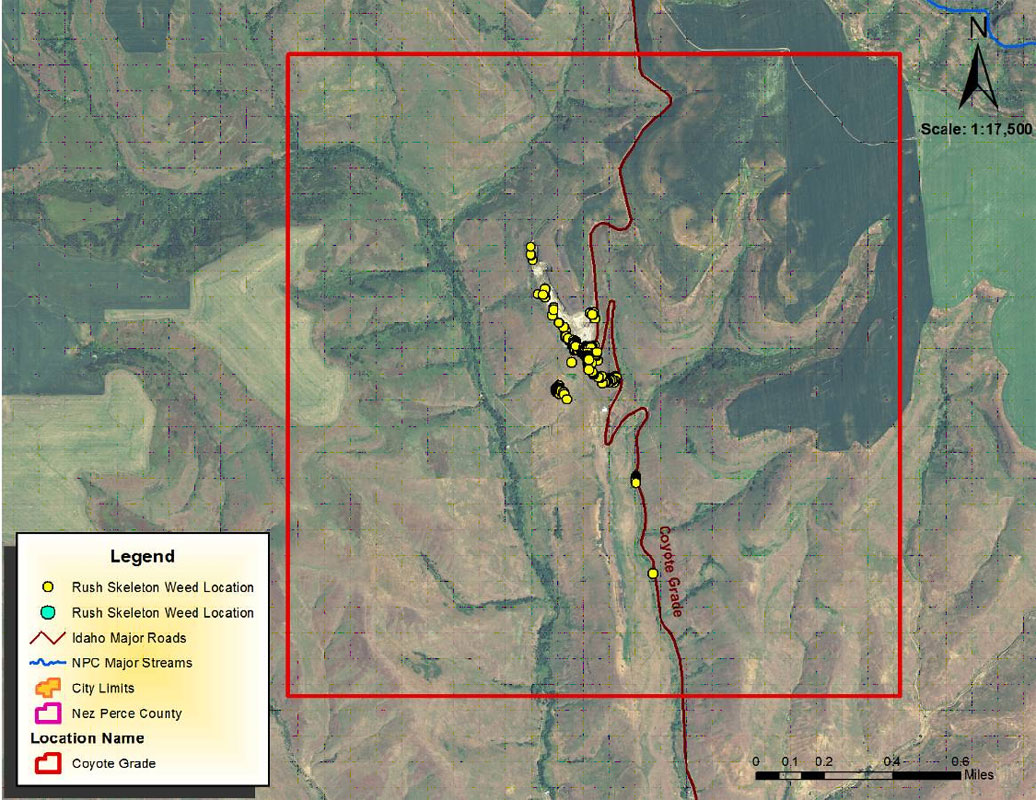
Figure 5. Sunnyside Bench Rush Skeletonweed Infestation Area Detail. Map Credit: Amanda Hall; Nez Perce Soil and Water Conservation District. 2013.
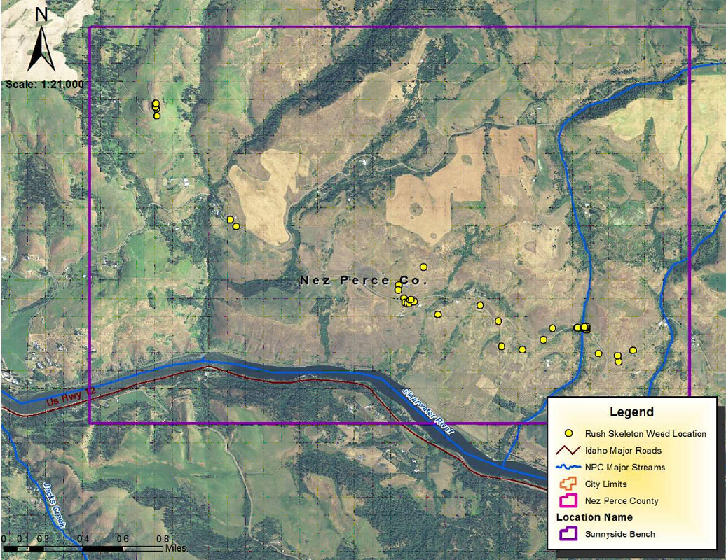
Figure 6. Peck Rush Skeletonweed Infestation Area Detail. Map Credit: Amanda Hall; Nez Perce Soil and Water Conservation District. 2013.
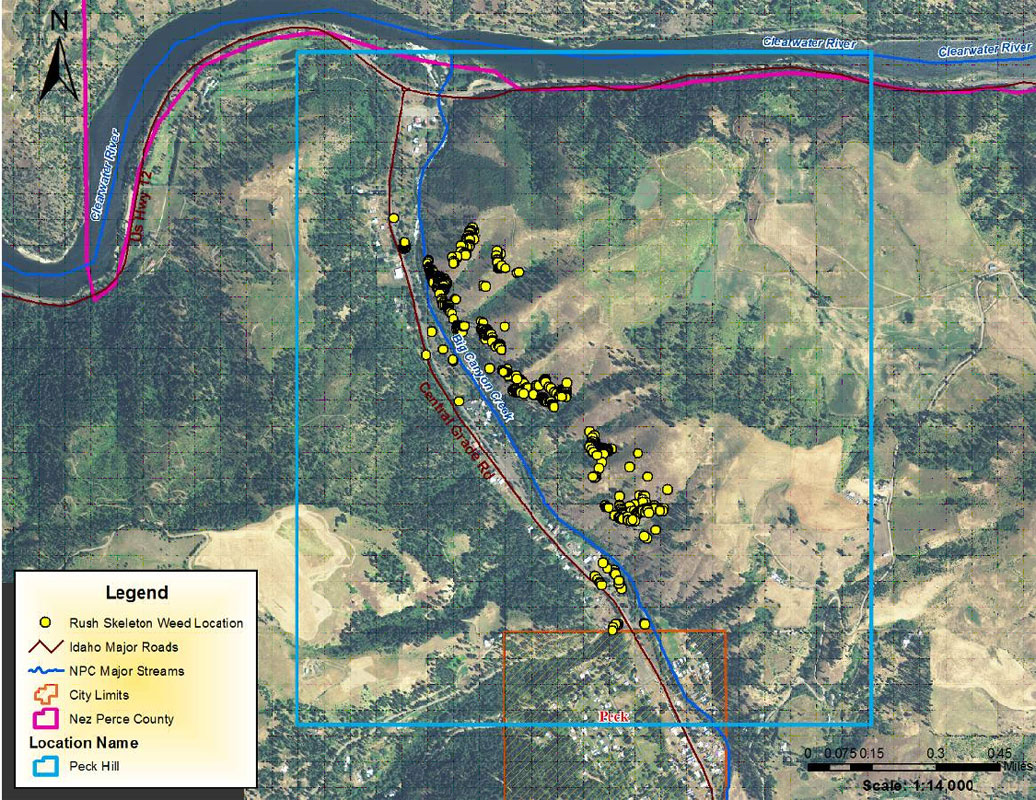
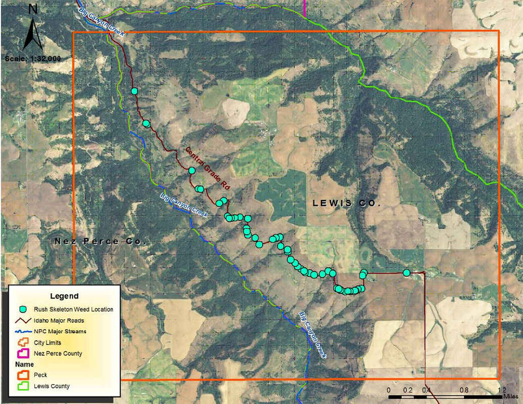
Figure 7. Lewis County - Central Ridge Road Rush Skeletonweed Infestation Area Detail. Map Credit: Amanda Hall; Nez Perce Soil and Water Conservation District. 2013.
The 2013 Rush Skeletonweed mapping report is available for downloading.
Rush Skeletonweed Mapping Project - 2013