Project are available on YouTube – press the links below to discover the details for this exciting project:
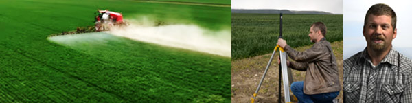
Check out the growers describe the project purpose!
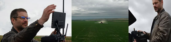
Discover the drone details!
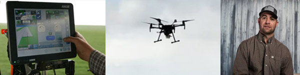
Find out the project successes and challenges!
Background:
In 2019, the Nez Perce Soil and Water Conservation District (NPSWCD) received a Conservation Innovation Grant to purchase drone based remote sensing equipment and analysis software to develop pest management prescriptions for use in precision agricultural technologies.
The NPSWCD is located at the confluence of the Snake and Clearwater River basins, which are important surface and ground water source areas. In addition, these streams provide critical Endangered Species Act (ESA) habitat for Snake River Steelhead and Spring Chinook. Because the major land use within the region is agricultural production (75%), proper farming practices are critical in protecting the area’s source waters.
One of the water quality pollutants which has been difficult to address are herbicides. Monitoring data collected in the lower Clearwater River tributaries by the Idaho State Department of Agriculture have documented pesticide detections in surface water. (Campbell, 2004).
Idaho agriculture relies on the use of pesticides for crop protection and crop health. The use of pesticides through the implementation of a pest management plan can benefit crop production as well as minimize risk to the environment and human health. The potential for surface water pollution from agricultural practices is a function of chemical properties, soil properties, land management at the application site, application techniques and the weather (Campbell, 2004).
Producers in the Clearwater and Palouse regions traditionally apply herbicides over an entire agricultural field. Herbicide applications are applied whole field versus targeting specific areas due to the lack of timely field scouting and prescription development.
Over 80% of new farm equipment sold today has some form of precision farming component (Adam, 2019). With the growth of precision farming technologies and the availability of high quality remote sensing tools available on drones, the NPSWCD and its partners hope to lead the local effort in obtaining the technology and developing specific agricultural uses for many aspects of conservation planning and implementation efforts.
The use of drones for remote sensing has been demonstrated for several applications in various industries. However, applications for conservation planning and implementation have not been thoroughly explored.
Methods:
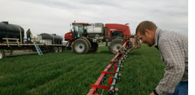
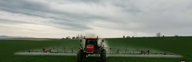
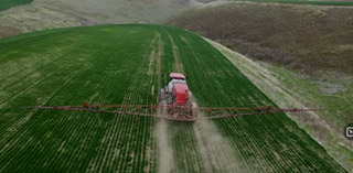
A field trial was conducted to demonstrate the use of the drone technology and pesticide application with two agricultural producers on 40 acres of winter wheat. Each producer provided 20 acres of cropland for the project. Each participant applied herbicides to 10 acres through the traditional method of entire field applications. They documented the production process and associated costs. These fields were used as a baseline for comparing the precision agriculture application methods. Each producer also had a 10 acre parcel where weed areas were identified with the drone based remote sensing and analysis used to build a pest management prescription and then the participants would apply herbicides as per the identified prescription.
 Tools:
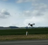
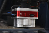
A DJI Matrice Drone with a MicaSense Altum multispectral was used to obtain aerial and spectral imagery the four plots (10 acres each). The imagery was post processed using Pix4D software. This software provided a georectified image for viewing in ArcGIS. The color spectrum for different vegetation was used to assist in identifying weeds within the wheat canopy.
 Software:
Pix4D Mapper software was used to convert aerial images and multispectral data from the UAV into geo-referenced mosaics, digital surface models and point clouds. Output file types include GeoTIFF and polygon shapefile formats. These products were used to generate NDVI and NDRE analyses as well as thermal heat maps.
 Field Testing:
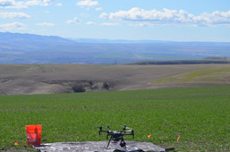
Our overall strategy was to employ the thermal/infrared sensor over approximately 40 acres of non-irrigated cropland. The initial drone imagery would then be processed to identify weeds within winter wheat fields. This information would then be used to target herbicide application on the targeted areas versus whole field application. A prescription would be built and uploaded to the producers existing precision agriculture equipment which will allow the use of precision ag technologies to turn on/off the sprayer in the targeted areas.
Results:
- Technical Feasibility-feasibility was determined by obtaining and evaluating feedback on ease of use, identification of processes that need improvement, and identification of processes that worked well. Evaluators included the growers, a conservation district board member, county extension agent, information technology specialist and data analyst. Overall, the equipment functions well, however, the feasibility of using the drone as a data collection tool for weed control in winter wheat is not feasible at this time. The technology would be better applied to spring crops where the weeds are emerging before or at the same time as the spring crop. For this project the winter wheat canopy blocked the drone sensors from viewing the underlying weeds.
Other components that need improvements include a reduction in data processing time. At this time the amount of computing time needed to process the large volume of imagery is excessive and prohibits a timely turn around to get information back to the grower.
- Herbicide Use Reduction-the comparison of the amount of herbicide used in the traditional application field versus the precision agricultural field. The reduction in herbicide use was not documented as planned as the drone flights could not be used to determine weed locations within the winter wheat canopy. The color spectrum of the winter wheat and the target weeds was too close and could not be separated to identify the weeds. In addition, the winter wheat canopy was taller than the weeds, which blocked the emerging weeds from being captured on the imagery. The two producers documented the herbicide use for the control plots and treated plots, but no differences were noted. The review team felt that the use of the drone to identify and target weeds in winter wheat in order to target herbicide application was not feasible at this time. The group noted that the technology may be applicable within 2 to 3 years and that use of this technology in spring crops would be more feasible than winter crops due to the weed and crop emergence timing being similar in spring crops. See discussion under challenges for additional details.
- Economic Analysis-the comparison of the treated/untreated filed production costs. No difference in the costs of production for the control plot and the drone prescription plots were found. This is due to the inability to use the drone imagery to identify target weeds within the winter wheat canopy. See notes under item 2 above.
- Weed Control Efficiency-the scouting of field and quantifying the weed density using the drone technology, treating the field with herbicides, and then re-flying the treated fields to determine the weed population. This part of the trial was very difficult to achieve. The time between collecting, analyzing and providing the data took too long. In addition, we had planned for weekly flights during the growing season. Due to weather, we could not fly the drone and capture data on the schedule, which did not provide timely data to the grower to spray the weeds. In the future, a better approach might be to field scout the target weeds present in the field and utilize the drone to document their presence and geospatial location, then build a prescription for treatment the following field season. Trying to fly, capture data, analyze and treat in a short time frame exceeded the staff resources we had available. On a larger scale, using the technology in this format, timing will be a concern that needs to be addressed. Winter wheat crops have a canopy in the spring that is taller than the emerging weeds Trying the technology on a spring crop where the weeds and the crop emerge at similar rates may be a better first step for using the technology.
Scale: It is not feasible to fly entire agricultural fields and having timely data in order to control weeds in the narrow window of time for herbicide application. The technology needs further developed and the battery, processing time, and weather conditions need further development.
Partners:
Thank you to the partners who made this project possible!
- Clint Zenner – Agricultural Producer (technical team member and provided land and equipment for ag production components of project).
- Steve Becker – Agricultural Producer (technical team member and provided land and equipment for ag production components of project)
- Steve Kaufman – Agricultural Producer (technical team member and participated in drone flights)
- USDA – Natural Resources Conservation Service (provided funding for the project)
- Nez Perce County Commissioners (provided matching funds and personnel for equipment set up and operation)
- Nez Perce Soil and Water Conservation District Board (provided matching funds and personnel)
- University of Idaho Extension (technical team member)
Forms developed for this project include:
Pix4D Mapper Processing Guide
UAV Flight Permission Form
UAS Flight Checklist
Ag Application Study Flight Checklist
Additional Resources can be found at:
Final Project Report – 2022 (click to view report)