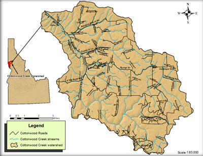
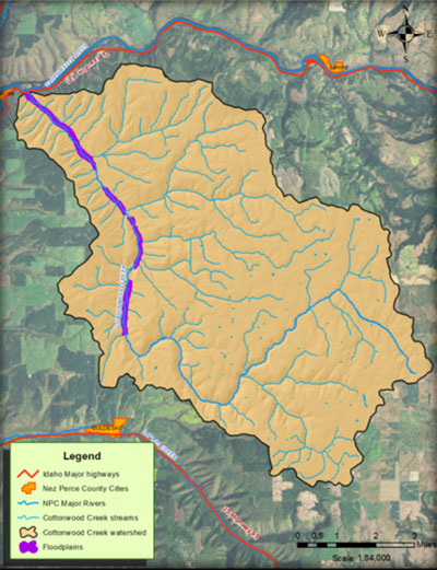
Location
Cottonwood Creek (PNRS #1160) (hydrologic unit # 17060306-069) is located in the Clearwater River hydrologic basin. The headwaters are located near Reubens, Idaho. The size of the watershed is 40,700 acres. Cottonwood Creek flows in a northwesterly direction through the Nez Perce Indian Reservation joining with the Clearwater River near Myrtle (Figure 1).
Figure 1. Cottonwood Creek location map
Elevations range from 850 feet at the mouth of Cottonwood Creek to 3,500 feet at the watershed headwaters. Rolling upland plateaus of non-irrigated cropland with steep canyon walls and a somewhat inaccessible canyon floor typify the topography.
Steep slopes and narrow bottomlands characterize the watershed. Generally, the north and east facing slopes are forested with various tree and shrub species, whereas the south facing slopes and the flatter plateau areas are cropland.
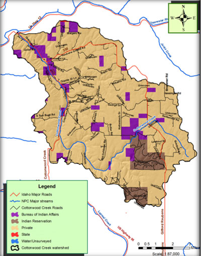
Ownership
The majority of the land within the watershed is privately owned (86 %). Table 4 delineates the extent of ownership, while Figure 2 maps ownership in the watershed.
Table 4. Cottonwood Creek watershed ownership.
| Ownership Type | Acres | Percentage (%) |
| Private | 634,867 | 86 |
| Tribal | 5,816 | 14 |
| Federal | 1 | <1 |
| State | 16 | <1 |
| Total | 40,700 | 100 |
Figure 2. Ownership map
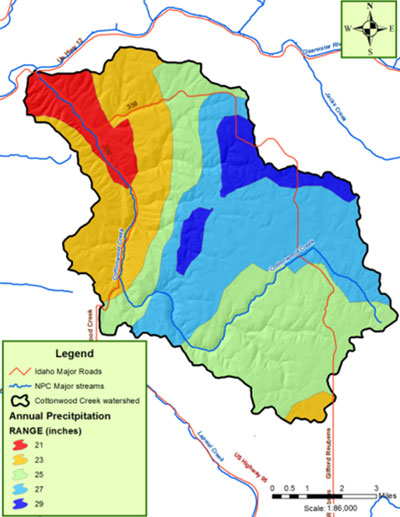
Climate
The Cottonwood Creek watershed has a maritime climate pattern characterized by cool moist winters and warm dry summers. This climate is typical for much of the Pacific Northwest, Columbia and Clearwater basins and results from air masses and storm systems moving inland from the Pacific Ocean. Average annual precipitation increases with elevation, ranging from approximately 21 inches in the lower portions of the watershed to about 29 inches in the higher elevation areas (figure 3).
Figure 3. Precipitation zones.
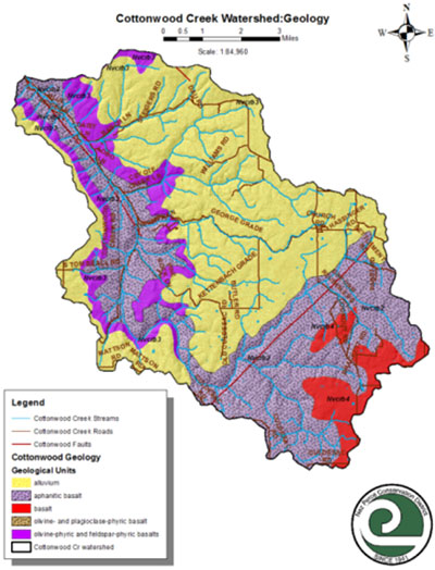
Geology and Lithology
Cottonwood Creek and its tributaries drain the ridges, draws and canyons between the Camas Prairie and the Lewiston basin. The area’s dominant formation is the Lewiston basin, a crustal depression between the Northern Rocky Mountains, the Blue Mountains, and the Palouse portion of the Columbia Plateau. Miocene basalt flows of the Columbia River Basalt Group are gently folded in this part of the Lewiston basin, and the streams have cut deeply into the basalt (Figure 5). Sediments of the Latah Formation are interbedded with the basalt flows, and landslide deposits occur where major sedimentary interbeds are exposed along the valley sides. The cooler and dryer climate of the Pleistocene brought on the cyclical deposition of wind-blown silt that forms the loess mantle on gently sloping basalt flows. In the late Pleistocene, multiple Lake Missoula Floods inundated the Clearwater River valley, locally depositing silt, sand, and ice-rafted pebbles and cobbles in the lower elevations of the canyons (Othberg, et al., 2003)
Figure 5. Geology Map.
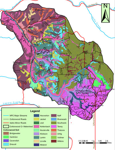
Soils
Twenty one soil series are identified for the Cottonwood Creek watershed. They include (ascending order by acreage): Riverwash, Vollmer, Cavendish, Joel, Meland, Hooverton, Bridgewater, Linville, Keuterville, Carlinton, Uhlig, Thatuna, Wilkins, Driscoll, Jacket, Klickson, Larkin, Taney, Kettenbach, Figure 6 below illustrates coverage of each soil series.
Figure 6. Soils map.
Land Cover
Land cover within the watershed, as displayed in Table 6, is divided into nine categories according to land cover GIS data provided by the GAP Analysis (Figure 11). Dominant land cover coincides with the dominant land use, with 61% of the watershed covered by cultivated crops.
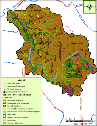
Table 7. Cottonwood Creek land cover extent.
| Cover Type | Acres | % |
| Agricultural Vegetation | 25,010 | 61.4 |
| Developed, Low Intensity | 1,230 | 3.0 |
| Forest and Woodland | 6,420 | 15.8 |
| Introduced Vegetation | 550 | 1.4 |
| Rock | 25 | 0.1 |
| Open water | 1 | 0.0 |
| Disturbed | 734 | 1.8 |
| Semi Dessert Shrubland | 60 | 0.1 |
| Shrubs and Grass | 6,670 | 16.4 |
| Total | 40,700 | 100 |
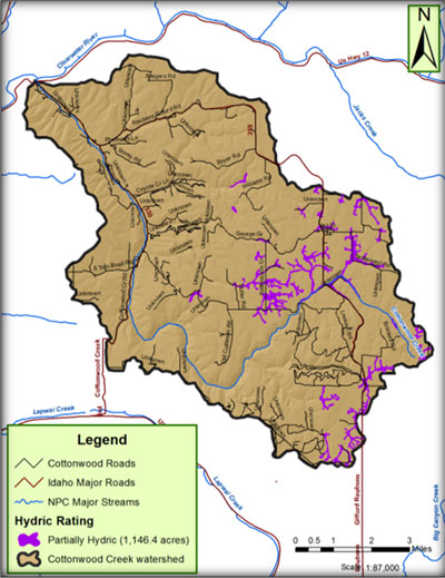
Wetlands
The USDA Soil Survey for Lewis/Nez Perce counties was used to determine the extent of hydric soils within the watershed. Approximately 1,647 acres were identified and are illustrated in figure 5.
Floodplains
There are FEMA mapped floodplains along mainstem Cottonwood Creek (Figure 13) which restricts development activities in the mapped areas. Cottonwood Creek has little access to it natural floodplain in the upper watershed where it has been channelized for the ease of farming. Additional floodplain impacts include roadways and dikes.
Roads
Road density of the Cottonwood Creek drainage averages 3.31 miles road/square mile.