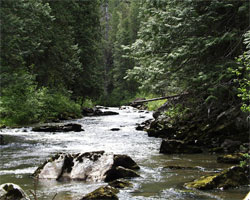
 The Potlatch River watershed is comprised of approximately 377,776 acres (590 square miles). It is characterized by steep basaltic canyons rimmed by rolling cropland in the lower reaches, and by timbered hills and high meadow terrain in the upper reaches. Potlatch River originates northeast of Bovill in the Beals Butte area. The basin ranges in elevation from 4,932 feet on Beals Butte to about 1,000 feet at the confluence with the Clearwater River. Potlatch River is the largest tributary to the lower Clearwater River Basin.
The principal towns within the Potlatch River watershed are Bovill, Helmer, Deary, Troy, Juliaetta and Kendrick. Potlatch River enters the Clearwater River west of the town of Juliaetta. The watershed is about 56 miles long and crosses the southern half of Latah County with roughly 1,900 miles of tributary streams. Annual precipitation in the watershed ranges with elevation. Annual precipitation in the valleys ranges from 15-20 inches and increases to 50 inches in the headwaters.
The majority of land (78%) within the watershed is privately owned. National forestland accounts for 52,368 acres (14%). The remaining lands are owned by the state of Idaho (7%), Bureau of Land Management (1%), and the Bureau of Indian Affairs (1%).
The majority of land within the Potlatch River watershed is comprised of 216,070 acres of forestland (57%) and 143,540 acres of non-irrigated cropland (38%). The cropland is used primarily for crop production and grazing. Forestland uses include timber harvest and management.
Fish habitat in the Potlatch River watershed is no longer suitable to sustain fish populations in many of its reaches. Spawning habitat in the lower 22.5 miles of the drainage has been degraded by scouring and siltation. Speckled dace (Rhinichthys osculus), Longnose dace (Rhinichthys cataractae) and Rainbow/Steelhead trout (Oncorhynchus mykiss) make up the majority of fish population within the watershed. Additional resident fish species include Brook trout (salvelinus fontinalis), Largemouth bass (Micropterus salmoides), Pumpkinseed (Lepomis gibbosus), Yellow perch (Perca flavescens), and Sucker (Cottus sp.).
Reference: Latah Soil and Water Conservation District, Resource Planning Unlimited, Inc.. (2007). Potlatch River Management Plan.