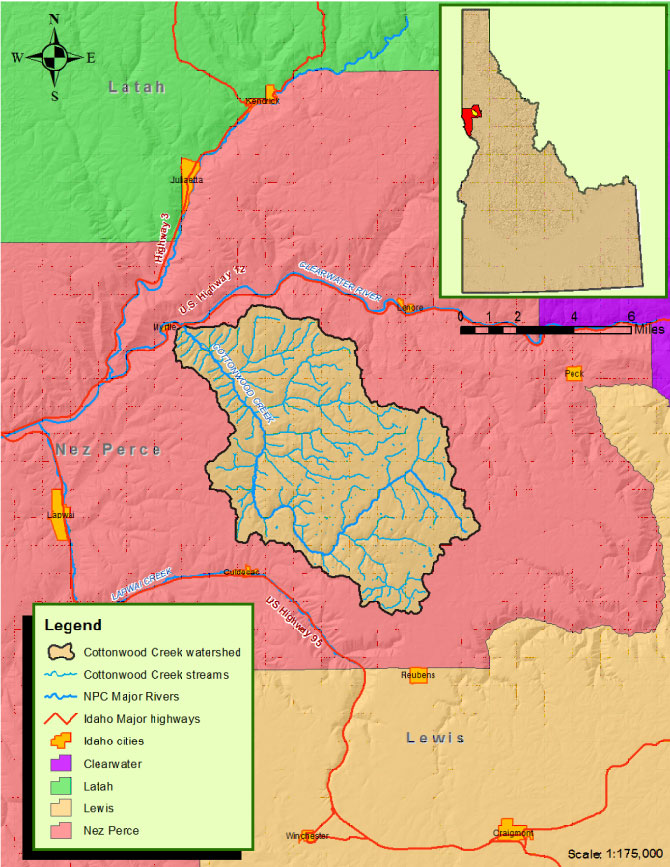
Cottonwood Creek is located within Nez Perce County, Idaho and is a tributary to the Clearwater River (figure 1). The watershed encompasses approximately 40,700 acres. The headwaters are located near Reubens, Idaho. Cottonwood Creek flows in a northerly direction through the Nez Perce Indian Reservation joining with the Clearwater River near Myrtle.
A watershed management plan was completed for this watershed in 2012. The detailed plan can be found in the resource library section.
Figure 1.
Watershed Improvement Needs:
The following needs were identified from the 2012 Cottonwood Creek Watershed Plan:
A – Improve riparian condition – 112 miles riparian restoration.
B – Reduce Stream bank Erosion – 87 miles stream bank protection.
B – Restore Floodplain Access and Reconnect Channel – 22 miles.
C – Improve watershed hydrology - Install 30 acres wetland enhancements, 1300 acres upland grass/forb planting, and 860 acres upland tree planting.
D – Reduce sediment delivery to streams from uplands – 6,322 acres upland treatment.
E – Remove or retrofit fish barriers – remove 13 barriers
E – Reduce Road Associated Sediment Delivery to the Stream – 9.5 miles road improvements
F – Protection Reaches – 20 miles of stream recommended for protection
In This Section:
- Discover Cottonwood Creek
This section describes the watershed’s physical characteristics, history, and provides an introduction to the watershed. - Learn the Issues
This section describes the watershed’s issues including agriculture, fisheries, water quality, and much more… - Resource Library
Find publications, photographs, videos, maps, and data regarding the watershed. - Take Action
Read here to determine how you can help!
Discover Cottonwood Creek
Cottonwood Creek is a tributary to the Clearwater River and encompasses 7,800 acres of agricultural and rangelands.
In This Section:
- The Watershed
Become familiar with the watershed’s physical characteristics such as soils, streams, plants, animals and infrastructure. - Cottonwood Creek 101
Facts about the watershed. - History
Discover the area’s geological history.
Learn the Issues
The major pollutants in Cottonwood Creek include sediment, high stream temperatures, and low stream flows. Learn more about the issues by selecting topics below.
In This Section:
Resource Library
The Nez Perce Soil and Water Conservation District collects resources for public use. Resources include photos, videos, maps, publications and data sets. As these resources become available they are posted here.
In This Section:
- Photos
View photos from the watershed. - Videos
View videos about the watershed. - Maps
View maps relating to the watershed. - Publications
To view the Cottonwood Creek documents, please go to our Publications page. - Data
View available data collected for the watershed.
Take Action
The District, private landowners and Nez Perce County finished a project within the watershed in 2017. This project is just one of many planned projects for the watershed. Landowners interested in helping improve the watershed in Cottonwood Creek are encouraged to contact the District office at 208.843.2931 or E-mail NPSWCD. This project is described below:
Cottonwood Creek Habitat Restoration Project Phase I
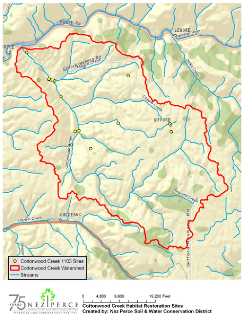
The Cottonwood Creek Habitat Restoration Project (SR1103) improves water quality and fisheries habitat within the Cottonwood Creek watershed of Nez Perce County, Idaho (Figure 1).
Figure 1. Location of Cottonwood Creek in Nez Perce County.
This project is Phase I of a 6 phase implementation strategy. Restoration sites were identified through the Cottonwood Creek Watershed Restoration Plan, completed through a separate SRBA project in 2012. This proposal focuses on the upland measures which were identified in the watershed plan.
The Nez Perce Soil and Water Conservation District (NPSWCD) received funds from the Idaho Governor’s Office of Species Conservation through the Snake River Basin Adjudication (SRBA) Habitat Trust Fund in 2011.
This project meets SRBA Habitat Trust Fund Agreement intent by addressing upland improvements, in stream habitat and riparian habitat vital to fish and wildlife. It establishes contacts with private landowners to inform and assist them with conservation needs on their properties. The habitat restoration plans identify areas for in stream habitat restoration potential, fish passage improvements, riparian habitat treatment areas, and wetland areas.
This project completed the following deliverables: (1) preparation of eight habitat restoration plans, (2) installation of 10 erosion control projects, (3) treatment of 1,776 LF of roads, (4) elimination of streambank erosion along 1,314 LF of stream, (5) installation of 2 livestock water developments, and (6) implementation of weed control measures on 51.6 AC. Project locations are shown in Figure 2.
Figure 2. Restoration Sites
Project expenditures totaled $187,289 with matching funds of $141,323 dollars. Matching funds were provided by private landowners, Nez Perce County, and the Nez Perce Soil and Water Conservation District in the form of in-kind and cash. To view the final project report go to the Cottonwood Creek Habitat Restoration Final Report.
Weed Control (2C)
Weed control included knotweed injection, biocontrol releases, and hydroseeding on a total of 51.6 acres.
Figure 2. Completed hydroseeding project.
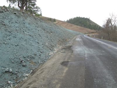
Figure 3. Biocontrol release on yellow starthistle.
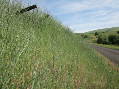
Figure 4. 2011 knotweed before treatment.
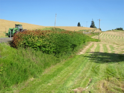
Figure 5. 2013 knotweed after treatment.
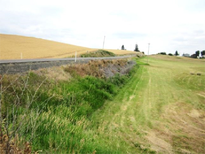
Road Improvements (2E)
Road improvement projects were installed at 4 sites for a total of 1,820 LF of road erosion reduction.
Figure 6. After road erosion project in 2012.
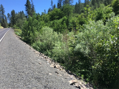
Figure 7. Before road erosion project in 2017.
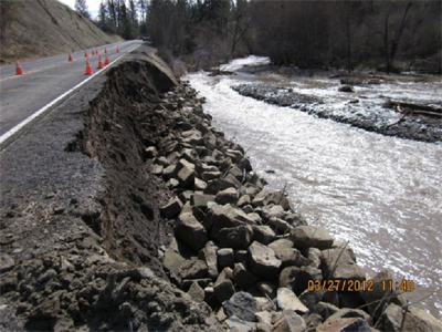
Figure 8. Before road erosion project in 2012.
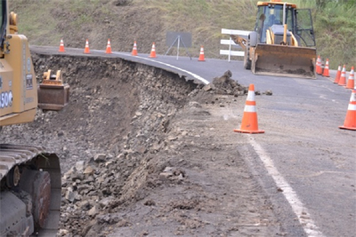
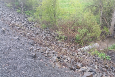
Figure 9. After road erosion project in 2015.
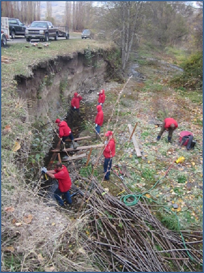
Erosion Control Measures (2F)
Erosion control measures were installed at 9 sites for a total of 1,314 LF of streambank protection.
Figure 10. Water development during construction.
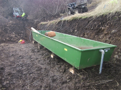
Figure 11. Finished water development.
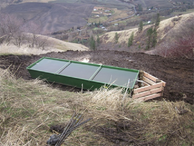
Figure 12. Tree planting 2017.
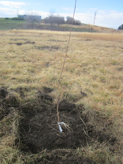
Figure 13. Streambank project 2017.
Publications, Videos, Press releases, and Other Materials Produced in Relation to this Project
The following documents were created in relation to this project:
- Cottonwood Creek Habitat Restoration Final Report – 2017
- Forever Soil and Water Newsletter for the following issues: Fall 2017, Summer 2017, Spring 2017, Fall 2016, Fall 2015, Summer 2015, Spring 2015, Winter 2014, Fall 2014, Summer 2014, Spring 2014, Winter 2013, Fall 2013, June 2013, February 2013, November 2012, Summer 2012, May 2012, April 2012. Electronic copies available at: Newsletters
- Cottonwood Creek Habitat Restoration Project page on District web site located at: Projects
- Video of hydroseeding. Available on You Tube at: NPSWCD YouTube. Video is titled "Cottonwood Creek Hydroseeding."