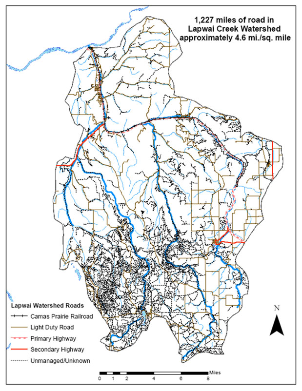
Activities associated with road building and road presence that may impact fish populations in the Lapwai drainage include increased sedimentation, stream and floodplain constriction, and in-channel changes due to roads and road construction. The legacy of extractive industry in Lewis and Nez Perce counties has resulted in a moderately high overall road density ranging from four to eight miles of road per square mile. This has contributed to slope failure and mass wasting events, surface erosion, altered channel morphology, changes to runoff characteristics and improperly designed stream crossings with the potential to impede salmonid migration.
Many of the roads in this system are paved or graveled. The more significant sediment problems resulting from the road system are largely concentrated in a few areas, including Tom Beall Creek and the headwaters of Sweetwater Creek on Craig Mountain. The estimated total sediment delivery rate is estimated to be 3620.73 tons, or approximately 3.12 tons per mile across 1160 miles of roads. Sedimentation is harmful to salmonids and resident fish alike and can affect salmonids at virtually all stages of life by reducing quality of and access to spawning habitat and juvenile cover; reducing available oxygen to incubating eggs and rearing juveniles; and contributing to elevated water temperatures (Furniss, et al., 1991).
Roads are present along the valley floor along mainstem Sweetwater Creek, Lapwai Creek, Mission Creek, and Tom Beall Creeks, often modifying stream function. Channels have been relocated to accommodate the roads, and in places, the roads take up most of the valley bottom. Throughout the basin, pullouts on roads are often located on the streamside, causing degraded channel condition and contributing to sedimentation and reduced stability. In 2005, the Tribe conducted a road erosion survey on tribally-held lands within the Lapwai Creek drainage and found that the Sweetwater Block of roads (roads within the upper area of the Sweetwater Creek drainage) alone contributed 259.720 tons of sediment into streams annually. To address this issue throughout the watershed, transportation plans are recommended to reduce overall road density and thus reduce impact to streams.
Approximately 123 miles of stream within the Lapwai Creek watershed were inventoried for barriers in 2003-2004. It was determined that nearly 60% of these total inventoried stream miles are currently blocked by barrier structures, representing 72.6 miles of habitat currently unavailable for anadromous salmonids within the watershed. A total of 208 crossings were inventoried, 78 of which were complete passage barriers to all life stages. Nearly one-half of the crossings were culverts, the most common type of structural passage barrier (NPT Lapwai Stream Crossing Report, 2004). A single, adequately-sized, bottomless archway is the most desirable type of culvert, as it most closely mimics natural stream conditions for passage, although a bridge is generally preferable (Furniss, et al., 1991). Only two bottomless archway-type culverts were identified within the basin.
Of primary concern in the Lapwai Creek basin, particularly in the lower section, is the presence of U.S. Highway 95 and a railroad prism running along, and occasionally immediately adjacent to the creek. The presence of those two structures restricts Lapwai Creek from accessing its natural floodplain in several areas and maintenance activities can be detrimental to stream function. Specifically, methods of erosion control, including riprapping or other hard stabilization efforts, can lead to incision and straightening of the creek. Uncontrolled erosion contributes to sedimentation, bank instability and reduced riparian function. Winter road maintenance and spraying to control weeds can introduce potentially harmful substances into the water table and directly to the stream. Developing methods to address these issues in conjunction with the Idaho Transportation Department will be crucial in restoring the streams within the Lapwai Creek watershed.
Figure 1. Road density in the Lapwai Creek basin.