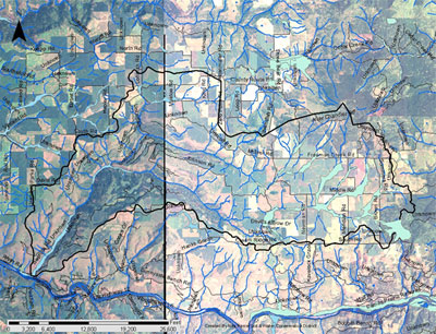
The Bedrock Creek drainage is a tributary of the Clearwater River entering the system approximately 23 miles above the confluence of the Snake and Clearwater Rivers at Lewiston, Idaho (figure 1). The watershed encompasses 25, 149 acres in western Clearwater and eastern Nez Perce counties. (Reference: Bedrock Creek Environmental Assessment, Sept. 1992.
The steeper land in the headwaters is located on rolling plateau ridgetops and canyon benches which were once forested. Elevations range from 4,140 feet at Teaken Butte, to 870 feet at the mouth of Bedrock Creek at the Clearwater River. A major tributary in the drainage is Louse Creek (10,479 acres).
Bedrock Creek Project Area Map
Bedrock Creek - Wheeler Canyon Watersheds, 2009
To view the Bedrock Creek documents, please go to our
Publications page.
Population and Ownership
According to the 1992 Bedrock Creek Environmental Assessment (1992 EA) about 300 people resided in the watershed boundaries with the majority residing on single-family farms or in the small rural communities of Cavendish and Southwick. In addition, the 1992 EA lists 65 farm operations in the watershed with an average size of 594 acres. The majority of the land is privately owned (95%). Table 1 illustrates the land ownership.
Table 1. Bedrock Creek Watershed Ownership (1992 EA)
| Ownership | Acres | Percentage (%) |
| Private | 23,857 | 95 |
| Nez Perce Tribe | 1,246 | 5 |
| Federal Lands | 17 | 0.07 |
| State Lands | 29 | 0.11 |
| Total | 25,149 | 100 |
Land Cover and Use
Five major land use categories have been identified within the watershed. Rangeland was defined to include native grazing lands with up to 10 percent tree canopy cover. Canopy densities greater than 10 percent are included in the forest land category. Data was obtained from the 1992 Bedrock Creek Environmental Assessment. Land use is shown in table 2.
Table 2. Bedrock Creek Watershed Land Use (1992 EA)
| Ownership | Acres | Percentage (%) |
| Non Irrigated Cropland | 11,586 | 46 |
| Pasture and Hayland | 1,511 | 6 |
| Rangeland | 3,335 | 13 |
| Forestland | 8,717 | 35 |
| Total | 25,149 | 100 |
Hydrology
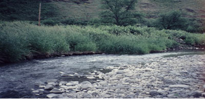
Peak runoff events normally occur when Chinook storms from the southwest rapidly melt the snowpack. A “normal” year may produce flows on the upper drainages of approximately 50-200 cfs for eight days in the spring. The mouth of Bedrock Creek will normally have flows of about 100 cfs during moderate periods and may peak at 400-600 cfs (1992 EA).
On February 24, 1986, discharge measurements were taken by the Nez Perce Tribe Fisheries Department after a particularly intense thunderstorm. An estimate of 800 cfs was recorded during the event. Periods of minimal flow discharges occur during the dry summer months and when the streams freeze solid during the winter. Normally the upper drainages dry up by late spring (1992 EA).
Reference
Bedrock Creek Environmental Assessment. United States Department of Agriculture Natural Resources Conservation Service. 1992.
Wetlands
The USDA Soil Survey for Lewis/Nez Perce counties was used to determine the extent of hydric soils within the watershed. Approximately 1,182 acres were identified and are illustrated in figure 2 (shown in light blue).
Figure 2. Bedrock Creek hydric soils.