Big Canyon Creek historically provided quality spawning and rearing habitat for A-run wild summer steelhead in the Clearwater River subbasin. However, high stream temperatures, excessive sediment and nutrient loads, low summer stream flows, and little instream cover have created anadromous fish habitat constraints in the creek. The primary sources of these nonpoint source pollutants and habitat degradations are attributed to agricultural, livestock, and forestry practices.
Big Canyon Creek watershed begins at 4,639 feet in elevation at Mason Butte in Lewis County near the farming community of Craigmont. It flows north for 31 miles through the Camas Prairie before draining into the Clearwater River north of the town of Peck at 950 feet in elevation. Average annual precipitation generally ranges with the elevation and varies from 18 to 27 inches per year.
The majority of land (88%) within the watershed is privately owned. The Nez Perce Tribe (NPT) owns almost 8,000 acres (9%), with most of those acres leased to non-tribal members. The remaining lands are under control of the Bureau of Land Management (3.6%) and State of Idaho (1%). 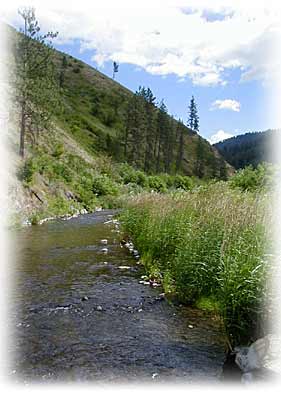 Rolling plateaus of non-irrigated cropland typify the watershed's upland areas. This agricultural land comprises over 60% of the watershed's acres. After leaving the uplands, drainages flow through U-shaped canyons with steep walls. Many of the canyon areas are classified as rangelands. The Big Canyon's rangeland areas and relatively inaccessible canyon floor are moderately to heavily grazed. Forestland acres are usually on the steep canyon slopes. These areas have been historically logged. Slopes in the watershed vary from 3 to 25 percent. Riparian vegetation is generally sparse in the accessible areas of the watershed.
The Big Canyon Creek watershed provides important habitat for both anadromous and resident fish, including Snake River Basin steelhead and Snake River fall chinook salmon, both of which are listed as "threatened" under the Endangered Species Act. Additional resident fish species include rainbow/steelhead trout (Oncorhychus mykiss), speckled dace (Rhinichtys osculus), northern pikeminnow (Ptychocheilus oregonensis), Piute sculpin (Cottus beldingi), bridgelip sucker (Catostomus columbianus), redside shiner (Richardsonius balteatus), brook trout (Salvelinus fontinalis), and chiselmouth chub (Acrocheilus alutaceus).
For more information about applying for this program, contact our office.
To view the Big Canyon Creek documents, please go to our Publications page.
Wetlands
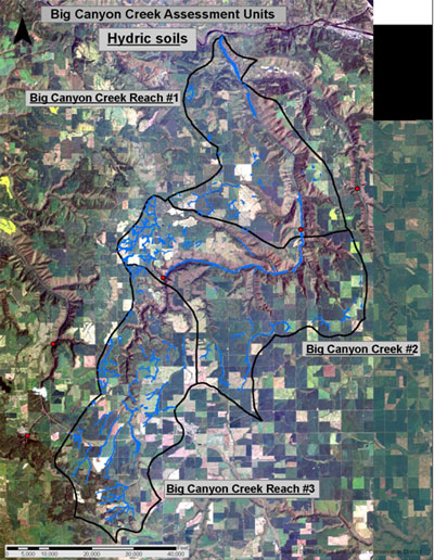
The USDA Soil Survey for Lewis/Nez Perce counties was used to determine the extent of hydric soils within the watershed. Approximately 6,863 acres were identified and are illustrated in figure 2 (shown in light blue).
Figure 2. Big Canyon Creek hydric soils.